Followers of this blog know that I enjoy exploring Europe on foot. I’ve generally gravitated to the mountain hikes, but I recently discovered a local hike right here been in Geneva that didn’t require getting into my car and driving up into the mountains. This hike’s main feature: the Rhône River.
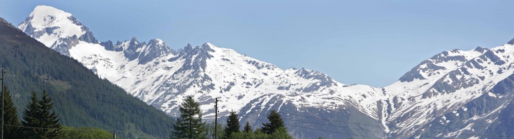
The Rhône is one of Europe’s major rivers, originating from glaciers in the Swiss alpine region called Valais. The river winds through the valleys of the Swiss Alps before feeding into Lake Geneva’s east end, near the city of Mantreux. I happened to just be in the Valais area in a town called Verbier visiting a friend, and I pulled over on the way home to take this photo of one of the mountain tributaries to the Rhône.

The Rhone getting a running start in the Swiss Alps
Usurped by Lake Geneva for its 70 mile length, the Rhône reconstitutes itself on the lake’s west end in Geneva. Shortly afterward, it is joined by the Arve River, then flows southward into France at the southern Jura mountains. From there, the river winds through the “Rhône Valley” (famous for its red wines) through the cities of Lyon, Valence, Avignon, and Arles, terminating at the Mediterranean Sea. Here’s a short video I took standing right at the confluence of the Rhône and the Arve.
The hike I took was on a path called – somewhat predictably – the “Sentier (path) de Rhône”. The path extends from Geneva to a town called La Plaine, about 20 kilometers away. My plan was to do about 14 kilometers of the hike, riding the bus to my starting point, and then walking back to the city.
Here is a map of my hike.
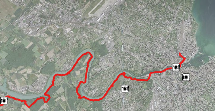
I hiked the red line.
Like most hikes I’ve taken over here, the trail itself is beautifully maintained.
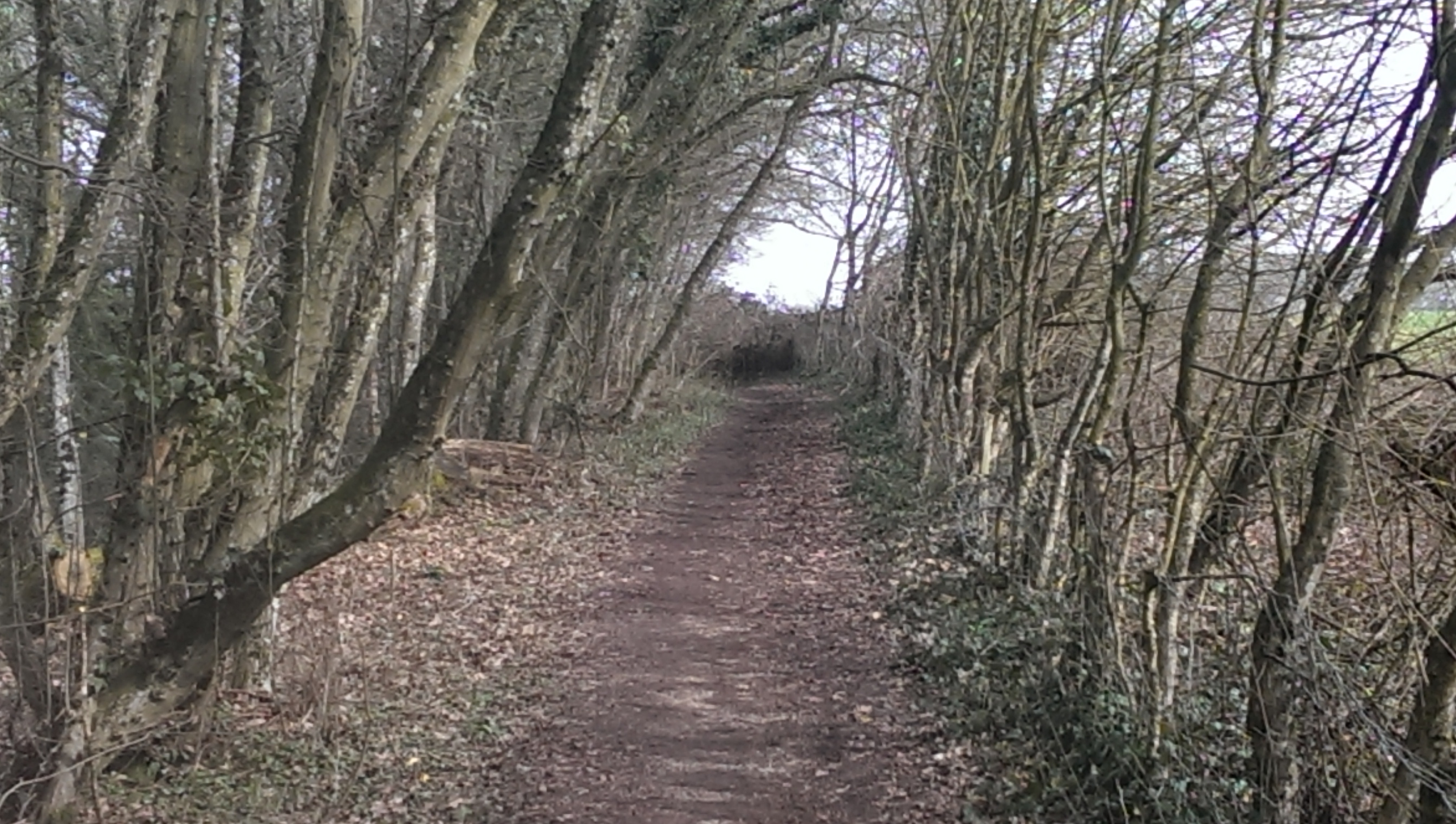
It is a beautiful trail, especially through the bird sanctuary.
Here’s a wildflower on the side of the trail. These were everywhere. I thought it was pretty cool to see blooming wildflowers in the middle of February.

A pretty flower on the trail, my keys for scale.
Here’s a look at the river from atop the bluffs, facing downstream.

The Rhone, flowing into southern France, to the Mediterranean Sea
I took this video of the best part of the hike. Through the bird sanctuary. Listen to the birds.
Here is a glacial deposit along the banks of the river.

Glacial deposits from 30,000 years ago
Here is a pretty awesome great big bridge over the Rhône.

This was the best shot I could get of the bridge.
The final destination for this hike was the old hydroelectric plant in the middle of the Rhône back in Geneva. Another distinguishing feature of the Rhône is the speed of its current, so they built a hydroelectric power plant in the river in 1880, and as you can see, it is a beautiful old building. This facility was the hub of industry in Geneva for a century, supplying thousands of homes with drinking water and electricity. In 1980, it was transformed into a cultural and arts center.

This hydroelectric plant generated power for 100 years, until 1980

That is beautiful!
Yes, it was. When you come visit, it’ll be hard to decide which hike to take you on.
It’s cool to see the glacial waters in the river! And what a gem to have this hike so close.